
Beyond the Trail
Narayangad's Forgotten Plateau
by
Soham Bhande
Narayangad, Verle: A Preliminary Historical and Structural Note
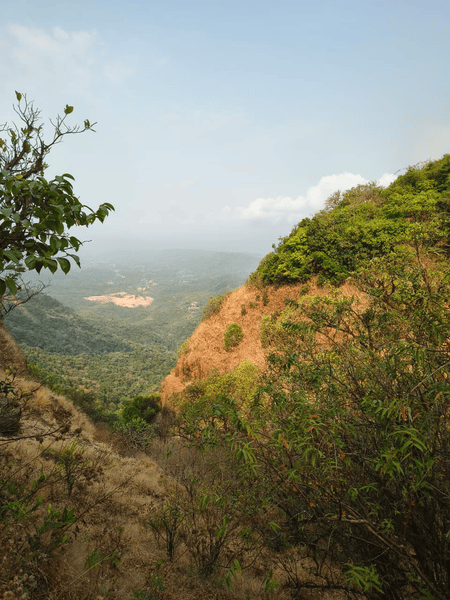
Narayangad is a hilltop structure situated near Verle village in the Amboli region of Sindhudurg district, Maharashtra. Located within the dense forest landscape of the Sahyadri ranges at an elevation of approximately 730 meters above sea level, the site overlooks the surrounding valleys and provides a clear visual connection towards Manohar-Mansantoshgad and the Kavalesad viewpoint. Today, Narayangad remains relatively unknown outside the local region, surviving mainly through oral traditions, literary references, and scattered structural remains visible on the plateau.
Although traditionally referred to as a “gad” (fort) in regional historical literature such as Sawantwadi Sansthanche Itihas, the site presently survives in a ruined condition with no standing architecture. The remains consist mainly of laterite stone foundations, carved stones, pillar bases, and traces of structural activity spread across the plateau. These remains indicate that the site once held architectural importance, though its exact nature and function remain uncertain.
The surrounding landscape of Amboli, known for its dense forests, heavy monsoon, and strategic hill routes connecting the Deccan plateau with the Konkan region, adds historical significance to the site. Despite this, Narayangad has received very limited archaeological attention, and most of the information regarding the structure survives through local memory and scattered literary mentions.
Location and Access
Narayangad is presently accessed through Gele village, near Amboli. The trek begins near the Gram Panchayat Office at Gele village and follows an ascending forest path leading towards the base of the hill. The route is comparatively easy and beginner-friendly, covering approximately 3 kilometres and taking around 30–40 minutes on foot.
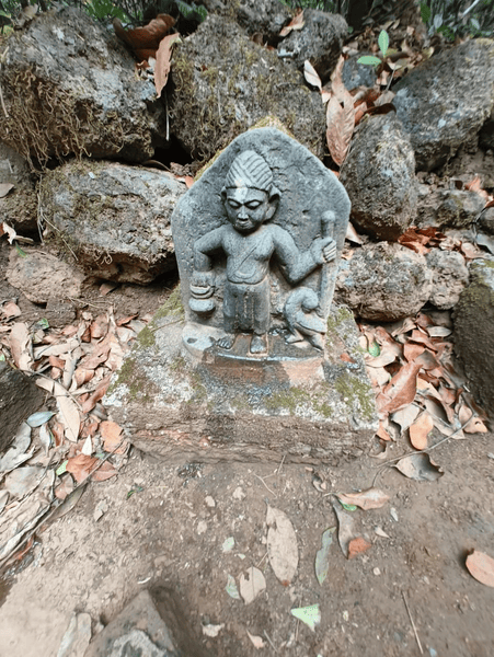
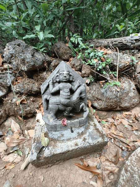
During the ascent, one reaches a small sacred shrine locally associated with Mhartal, a Local deity, containing a Shivling along with sculptures identified by villagers as Bhairi. This shrine acts as an important cultural landmark before the final climb towards Narayangad. The final ascent from the shrine takes around 15–20 minutes through dense forest vegetation. A narrow but clearly visible pathway created through regular local movement eventually opens onto the plateau of Narayangad.
Unlike many established forts of the Sahyadri region which use steep cliffs and difficult ascents as natural defensive mechanisms, the approach towards Narayangad is comparatively simple and accessible.
Structural Remains at Narayangad
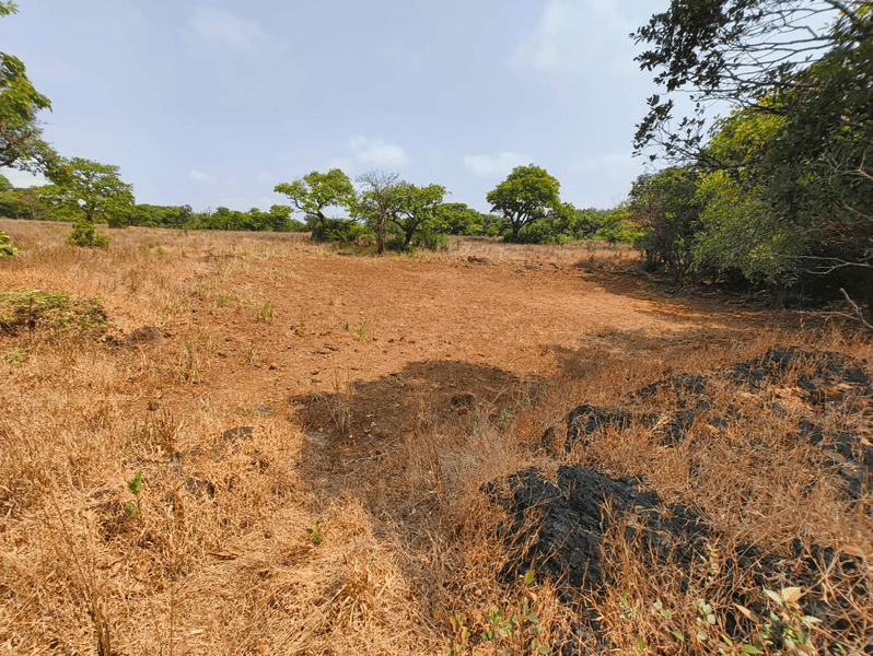
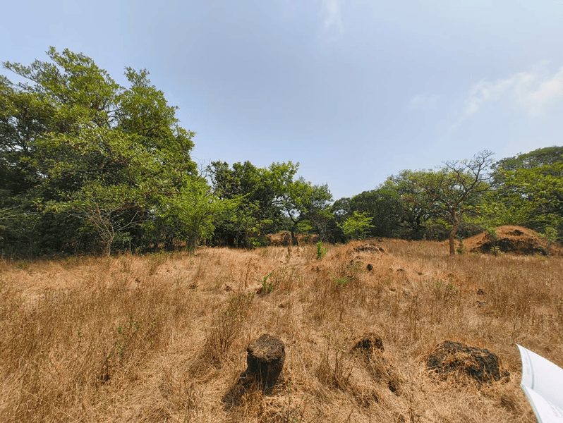
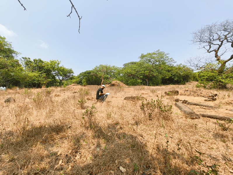
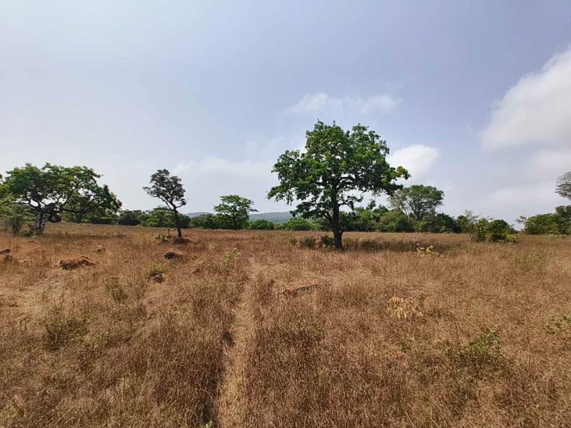
The present condition of Narayangad is entirely ruinous, with no standing structures surviving today. The plateau contains scattered laterite blocks, foundation alignments, carved stones, and traces of architectural activity distributed across different sections of the site.
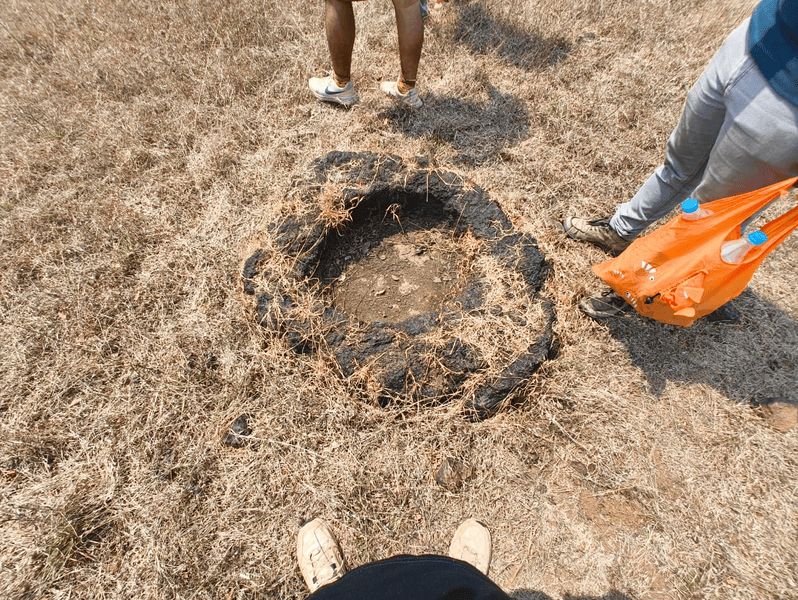
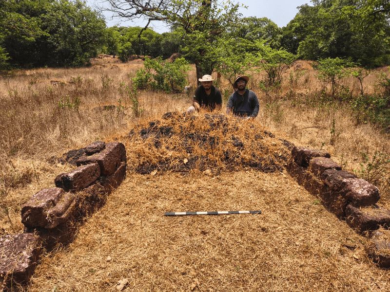
At the entrance plateau, a circular laterite stone structure is visible, possibly serving a functional or mechanical purpose rather than a defensive one. Nearby, the remains of an L-shaped foundation made from laterite stones can also be observed. These foundations suggest the existence of constructed spaces rather than military fortification.
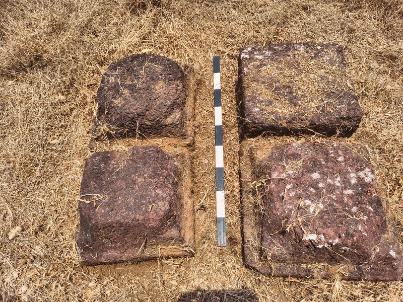
Further inside the plateau, additional structural remains become visible. These include rectangular and square-shaped foundations built primarily using laterite stone, a material widely used throughout the Konkan region because of its easy availability and durability. Scattered carved stones and architectural fragments are spread throughout the area, indicating the collapse of former structures. One of the notable observations at the site is the presence of octagonal carved pillar bases arranged in a 2×2 formation.
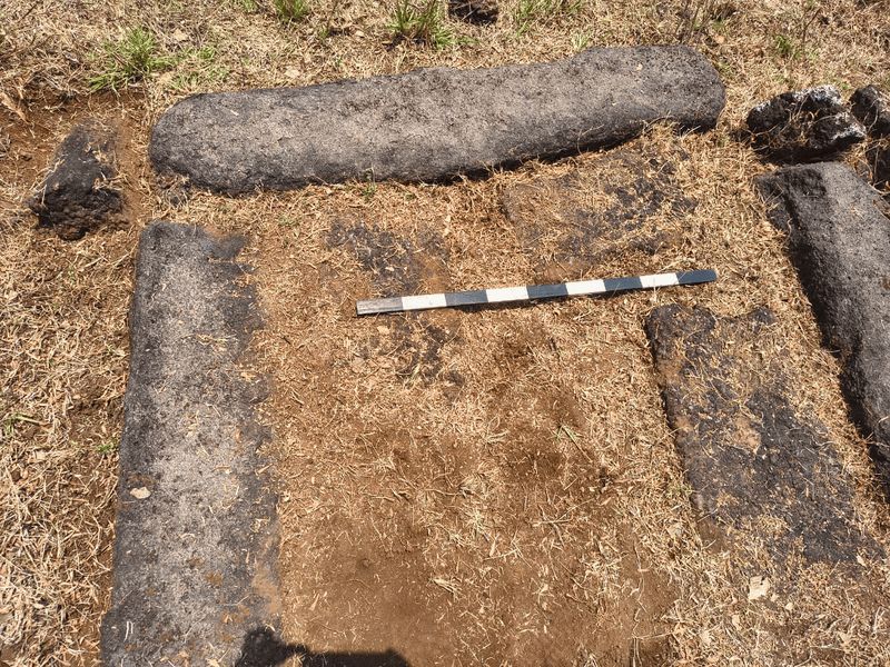
Another major structural cluster consists of a rectangular foundation aligned in a north-east orientation. The remains suggest the presence of a constructed building, though no clear entrance system or defensive arrangement is visible. Near this structure, a carved basalt stone with a circular hollow is also present, possibly functioning as a structural or mechanical installation.
A low-lying depression located behind the structural complex is locally identified as an earlier water source. Evidence of water erosion on surrounding stones supports the possibility of long-term water accumulation or storage activity in this section of the plateau. Overall, the structural remains at Narayangad indicate architectural and functional activity on the hilltop.
Historical References
The historical identification of Narayangad mainly comes from Marathi literary sources, specifically the Sawantwadi Sansthanche Itihas, where the site is mentioned alongside several places associated with the territorial framework of the Sawantwadi Sansthan. The text references Narayangad in administrative and territorial listings but does not provide any detailed architectural description of fortification walls, bastions, gateways, or military arrangements.
The references indicate that Narayangad held regional importance during the Sawantwadi period, though the exact nature of this importance remains unclear. The literary use of the term “gad” may therefore represent a conventional or territorial designation rather than confirming the presence of a fully developed military fortification.
The site is also listed in the District Census Handbook: Sindhudurg (2001) among historically important forts of the district. However, this administrative recognition similarly lacks any detailed architectural evidence supporting its classification as a fort.
Based on present observations, Narayangad does not exhibit major defensive features typically associated with established forts of Maharashtra such as fortification walls (tatbandi), bastions (buruj), controlled gateways, defensive zoning, and strategic cliff-based access systems. The site appears closer to a small hilltop outpost, observation point, or regionally important elevated settlement associated with movement and surveillance across the Amboli forest routes.
Local Narratives and Cultural Memory
Local oral traditions connected with Narayangad continue to survive mainly through the villagers of Gele. Although the land presently falls under the jurisdiction of the Forest Department, Sawantwadi, the villagers of Gele actively assist trekkers and visitors and are responsible for maintaining the cleanliness of the pathway and surrounding area.
According to local narratives, Narayangad functioned as a site associated with ammunition-related activity during the nineteenth century, although no direct archaeological evidence presently confirms this claim. Villagers also state that the original settlement of Gele was once located closer to the Mhartal shrine situated along the trekking route. Over time, the settlement gradually shifted lower towards the present village location for easier access to water, agriculture, and habitation.
The villagers further narrate that the Ravalnath and Sateri temples presently located in Gele village originally stood near the Mhartal shrine area and were later relocated alongside the shifting settlement. However, the Mhartal shrine itself remained at its original location because, according to local belief, the deity “did not wish to move.”
Even today, the villagers of Gele continue to treat the route and the hilltop with cultural respect. Vehicular movement beyond the Gram Panchayat area is discouraged locally in order to preserve the forest environment and avoid disturbance to wildlife.
The documentation presented here is the result of independent field study conducted by Soham Bhande. All rights to this work remain with the author and are published on Trip and Tales under his authorization. Trip and Tales holds no ownership over this content.
Trip and Tales sincerely thanks Soham Bhande for permitting the publication of his work for the benefit of readers and heritage enthusiasts.