
¤ 7 minutes Read
Palakkad Travel Guide: Nature, Heritage & Places to Explore
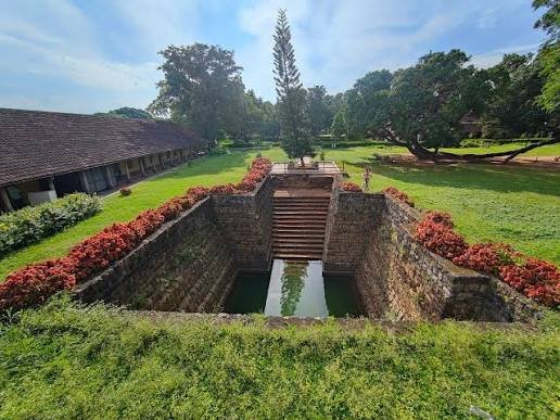
Palakkad lies at the foot of the Western Ghats in central Kerala, where broad paddy fields gradually give way to forested hills and mountain landscapes. Agriculture has shaped much of the district, earning it the familiar name “Granary of Kerala.” One feature has had an especially strong influence on the region: the Palakkad Gap, a natural break in the Western Ghats. It has long provided an important passage across the mountains and helps explain Palakkad’s historic role in trade and travel between different parts of southern India.
Culture Shaped by a Borderland
Palakkad’s position near the Kerala-Tamil Nadu border has influenced everyday life in ways that go beyond geography. Malayalam is dominant across the district, but Tamil influences are also noticeable in some communities, traditions and food.
The district is particularly important in Kerala’s musical history. Palakkad Mani Iyer, one of the most influential mridangam players in Carnatic music, was born here, while Palakkad has produced and supported generations of classical musicians.
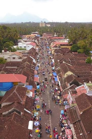
Temple Street
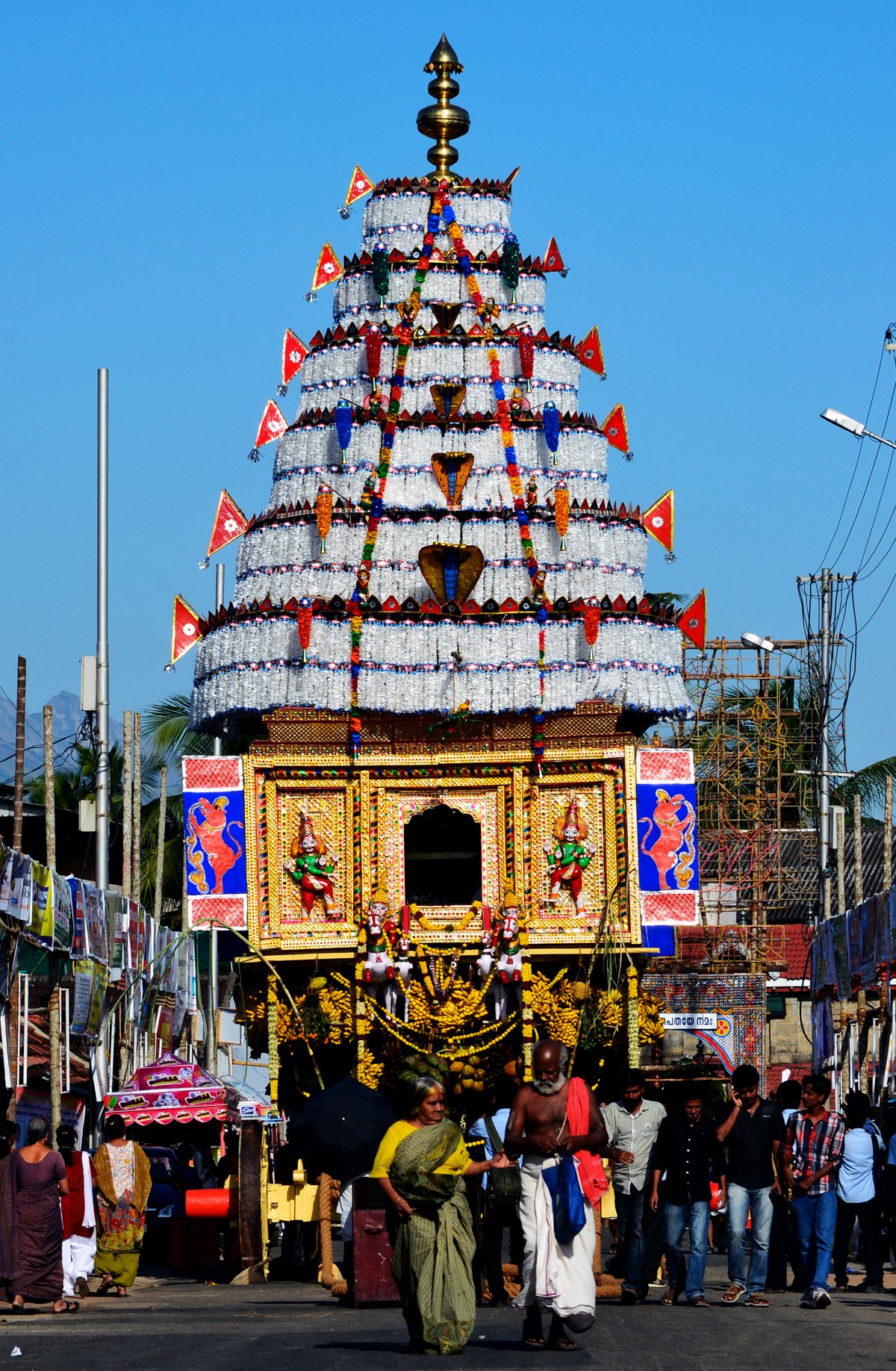
Kalpathy Radham Chariot
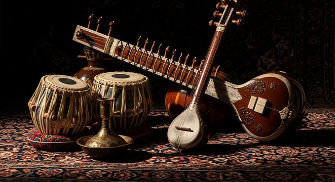
Classical Music
Local festivals provide another window into the region. Kalpathy Ratholsavam, held in the heritage settlement of Kalpathy, is centred on a traditional chariot procession through streets lined with old agraharam houses. The festival and settlement reflect the long-established Tamil Brahmin community in Palakkad.
Palakkad’s Wild Side
Beyond its farmland and towns, Palakkad reaches deep into the Western Ghats, where some of Kerala’s important protected forests are found.

Silent Valley National Park

Parambikulam Tiger Reserve.
Silent Valley protects one of the best-preserved stretches of tropical evergreen forest in the Western Ghats. Its difficult terrain helped keep large parts of the forest relatively undisturbed, and the national park is particularly associated with the endangered lion-tailed macaque.
Farther south, Parambikulam has a different character, with forests, reservoirs and a larger wildlife landscape. Elephants, gaur and several other mammals occur here, while the reserve is also part of the wider Anamalai landscape.
Together, these forests show a side of Palakkad that is very different from the paddy plains around the city.
Where the Paddy Fields Meet the Western Ghats
Away from Palakkad town, much of the district opens into farmland. Paddy fields, coconut palms, irrigation channels and small settlements occupy the plains, while the Western Ghats remain visible along the horizon.
Rice cultivation has played an important role in Palakkad’s economy and identity for generations. The extensive agricultural landscape is the reason the district is often called the “Granary of Kerala.” Yet the scenery can change quickly. Travel towards the edges of the district and the flat fields begin to give way to plantations, reservoirs and forested slopes.
This contrast is one of the most distinctive things about travelling through Palakkad. You do not need to reach a specific viewpoint to notice it. The transition from cultivated plains to the Western Ghats is visible along ordinary roads across the district.

The Palakkad Gap: The Break in the Mountains
The Western Ghats form an imposing mountain chain along much of Kerala, but near Palakkad they open into a broad, low passage known as the Palakkad Gap. Stretching for roughly 30 kilometres, it is one of the most prominent natural breaks in the range.
This opening has influenced Palakkad for centuries. Routes through the gap connected Kerala’s interior with the plains to the east, allowing people, goods and armies to cross the mountains more easily than in surrounding regions.
The gap also affects the local environment. It allows winds to move across the Western Ghats, contributing to Palakkad’s characteristically warmer and windier conditions in parts of the district.
Palakkad Fort: A Landmark Shaped by Rival Kingdoms
In the middle of Palakkad town, Palakkad Fort provides a sharp contrast to the district’s open agricultural landscape. The present fort was built in 1766 under Hyder Ali of Mysore, at a time when control of this route through the Western Ghats had considerable military importance.
The British captured the fort during the Anglo-Mysore conflicts, and control changed more than once before it finally came under British occupation in 1790. Today, the Archaeological Survey of India protects the monument.
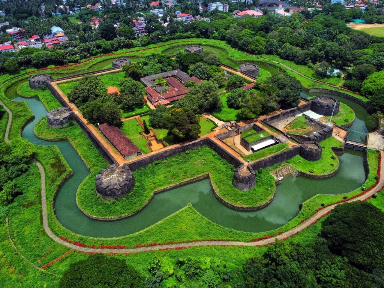
The structure is compact and strongly defensive. Thick laterite walls form an almost square enclosure, surrounded by a moat. A bridge leads through the main entrance into the fort, where the open interior makes it possible to walk along parts of the old defensive layout.
One detail worth noticing is how low and solid the fort appears compared with the elaborate hill forts found elsewhere in India. Its design was primarily practical: this was a military position controlling an important approach through Palakkad.
Places Worth Adding to a Palakkad Itinerary

Nelliyampathy
A hill destination surrounded by tea, coffee and spice plantations, with winding roads and viewpoints overlooking the Palakkad plains.

Kava
A peaceful spot near Malampuzha Reservoir, known for its open waters, grass-covered surroundings and Western Ghats backdrop.
Kalpathy
One of Palakkad’s historic neighbourhoods, recognised for its agraharam streets, old temples and the annual Kalpathy Ratholsavam.

Meenvallam Waterfalls
A forest-fringed waterfall near Karimba, where water descends through a series of rocky levels. It is a pleasant nature stop away from Palakkad’s busier attractions.
A Different Side of Kerala
Palakkad does not have the backwaters of Alappuzha or the high-altitude scenery associated with Munnar. Its appeal is quieter and more spread out: paddy fields beneath the Western Ghats, old neighbourhoods, reservoirs, forests and working agricultural landscapes. The district is especially rewarding when explored beyond Palakkad city. Within the same journey, the scenery can shift from open plains to dense forest and hill country, showing a side of Kerala that is easy to overlook on more conventional tourist routes.
Explore Kerala
Varanasi Blogs
- Uttar Pradesh Cultural guide
- Places to visit in Varanasi
- Places to visit nearby Varanasi
- India’s most popular destination
- India’s archaeological marvels
Recommended articles
- Uttar Pradesh Cultural guide
- Places to visit in Varanasi
- Places to visit nearby Varanasi
- India’s most popular destination